Features
- Implementation base on high performance cloud computing client - server architecture
- Support multithreading 32 / 64-bit windows OS
- Use the latest JAVA implementation technology and developed with a modular design
- The intuitive and easy-to-use interface
- SAR echo signal simulation using GPU parallelization for Space- / Air-borne and Ground-base system
- Flight path or movement trajectory simulation for Space- / Air-borne and Ground-base system
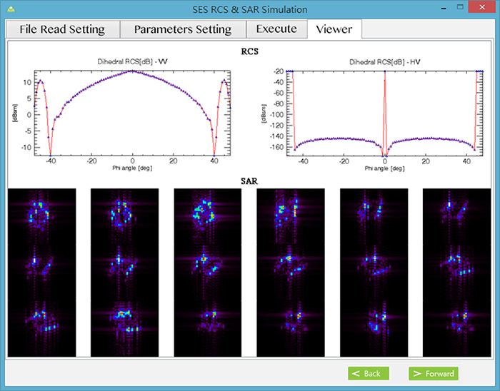
- Real-time Visualization for 3D Radar Cross Section rendering
- Reconstruction solution for connection between SAR echo, image and feature database
With File Manager UI Real Cloud Solution
Supported by cloud computing, users can enjoy high-speed processing of SAR Echo Simulation.
With SES, parameter-setting will be the only thing you need to do.

Select Easy
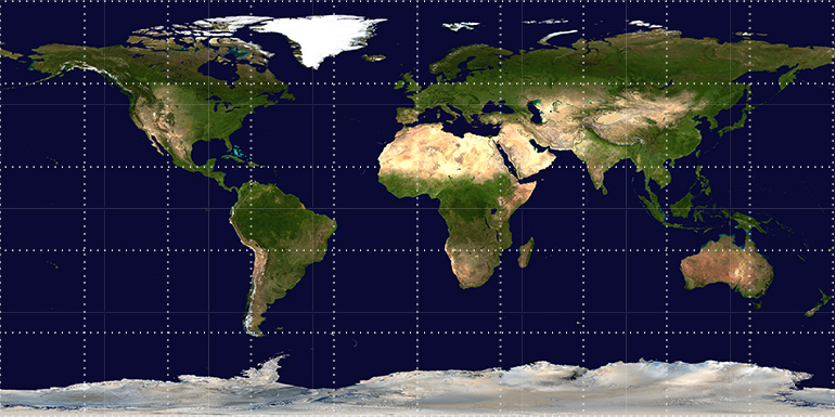
Using world terrain map to specify location
It's easy to simulate targets on the specified position
Radar Cross Section Estimation
Don't waste your time to collect or purchase RCS ( Radar Cross Section ) database
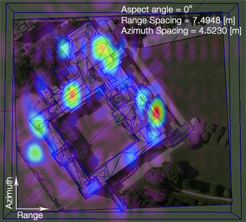
Convenience and ease of use of SES which can simulate via SketchUp or 3D MAX models
High Quality End-products
Intuitive task flow and excellent image display