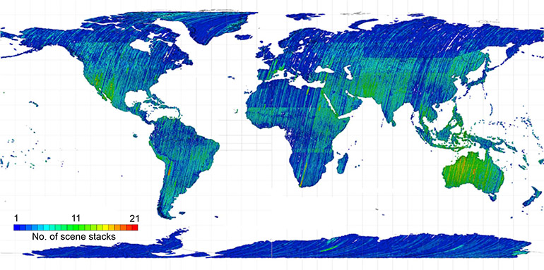
Original Data Acquisition Result
Global archive of PRISM stereo scenes ( 35 km x 35 km ).
Over 1 million stereo or triplet sets with cloud level < 30 % / scene in global.
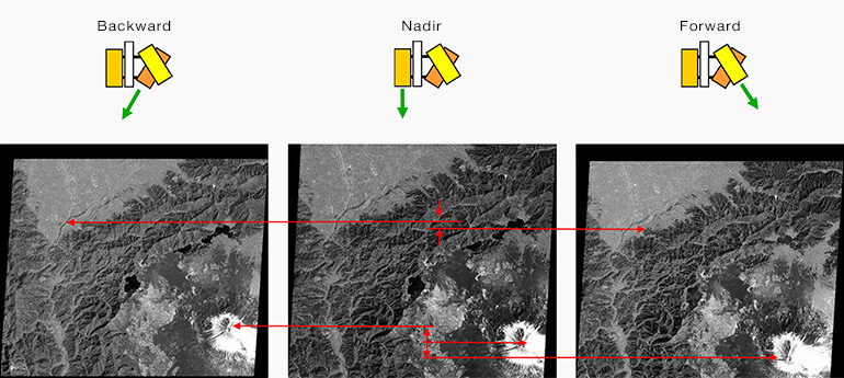
How to Measure Height from Stereo Image
Location differences are depends on the terrain height.
Derive digital elevation model ( DEM ) or digital surface model ( DSM ).
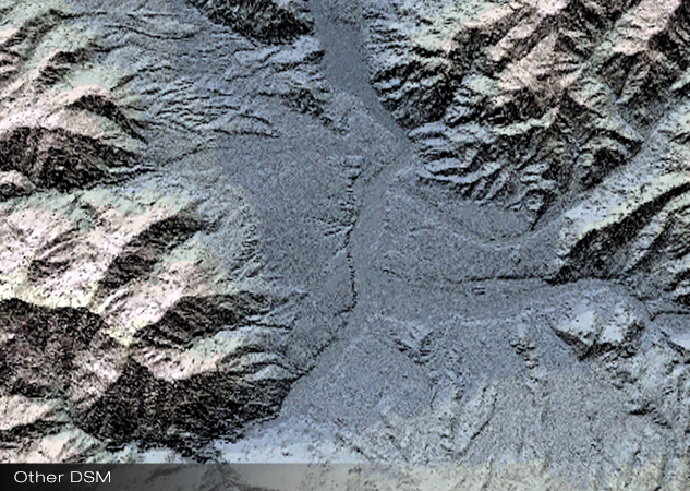
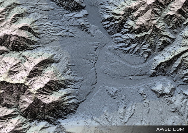
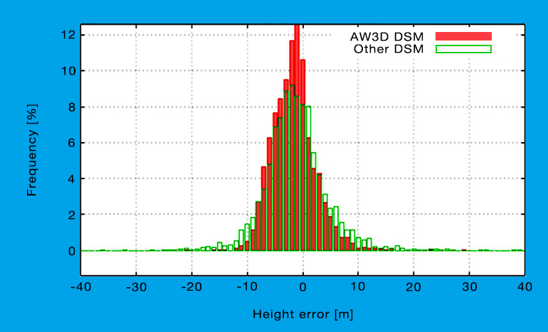
Validation Result of AW3D 5m DSM
Stats of height validation with 3,890 CPs in 85 tiles.
The AW3D height accuracy achieved 4.31 m ( RMSE ).
Product Level
| Level 1 | Level 2 | Level 3 | |
| Type | Digital Surface Model ( DSM ) | Digital Surface Model ( DSM ) | Digital Terrain model ( DTM ) |
| Coverage | Global ( land ) | ||
| Unit | Tile ( 1 degree X 1 degree ) Mesh ( 0.2 degree X 0.2 degree ) AOI |
AOI | AOI |
| Resolution | 5 m | ||
| Horizontal accuracy | 5 m ( RMSE ) | ||
| Vertical accuracy | 5 m ( RMSE ) | ||
| Coordinate system | Geographic Lat / Lon ( ITRF97 [ GRS80 ] ) | ||
| Format | GeoTIFF | ||
| Image files | DSM ( 16-bit integer ) Mask image |
DSM ( 16-bit integer ) Mask image |
TBD |
| Height type | Ellipsoid height | Ellipsoid height or Elevation ( height above sea level ) |
Ellipsoid height or Elevation ( height above sea level ) |
| Minimum sales area ( AOI ) |
400 km2 | ||
| * AOI:Single polygon with 4 or more vertices. Each side: 10 km or more. Each angle: 90 degrees or more. | |||