Streaming Terrain for Modeling & Simulation
“OPCube World Server – Enterprise” is offered as an off-the-shelf rack-mountable appliance ( just plug it into your network and connect ), or as a custom install onto user-provided hardware. Our professional support team can even work with you to pre-configure with custom data, or host a dedicated instance for you in the cloud.
“OPCube World Server – Enterprise” is a simple, yet powerful, web-based Streaming Terrain Server. You can easily populate it with your own custom source data through a web-based interface. The server can be deployed on private, classified networks to provide streaming terrain data to a variety of simulation and visualization applications behind your firewall.
“OPCube World Server – Enterprise” uses open standards such as WMTS, WMS-C, WFS, and TMS. This means that clients are not limited to airGmap’s visualization or simulation tools. Any customer or third party application that supports WMTS, WMS-C or TMS ( including web applications ) can access “OPCube World Server – Enterprise” immediately.
Features
- Streaming imagery and elevation.
- Based on Open GIS standards.
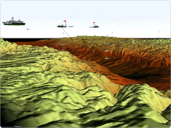
- Correlation between CGF and IG.
- Deployable on private networks.
- Includes more than 3TB of global data.
- Web-based configuration.
- Host and manage your own data.
- Rich API set of Web Services to access Terrain Agility.
- Flexible Deployment - Off-the-shelf appliance or custom install.
Pre-loaded Data for High Performance Access, Including
- Global elevation. 90-meter ( DTED Level 1 ) for the entire globe, based on the CGIAR-CSI version of NASA’s SRTM30 dataset, merged with SRTM30Plus bathymetry.
- Global elevation. 30-meter for the entire globe, including land and ocean ground base, based on the latest release version of Aster GDEM.
- Global imagery. Landsat 7 ( 15m resolution for the entire globe ) merged with NASA Blue Marble data ( 500m resolution ), color-corrected for seamless display, and pre-tiled to 7 map levels.
- High-resolution inset areas. The insets range from 1m to 15cm per pixel – including global airport areas and interest areas by demands.
- Highly detailed map, which includes:
- Global Place-names.
- Global Road Networks.
- Global Target POI – airports, harbor and suspected military interesting hotspots.
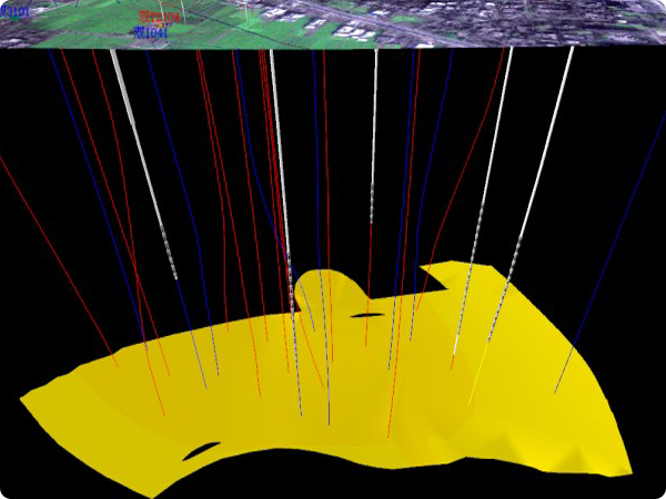
Terrain Agility
With “OPCube World Server – Enterprise”, you can quickly and easily supply your simulation application with the terrain information it needs. Using the API set of terrain-independent Web Services, you can execute high-performance mission functions including height-of-terrain ( HOT ) checks, line-of-sight ( LOS ) tests, and feature queries regardless of which type of terrain you use. “OPCube World Server – Enterprise” supports all of the major terrain approaches: hand-modeled, tool-generated, direct-from-source, and Open Streaming Terrain.
Terrain-Independent API
“OPCube World Server – Enterprise” can load, page, or stream terrain from a wide variety of formats or sources into a single, consistent run-time representation consisting of a collision graph and vector network. The highly optimized collision graph, based on the popular Bullet physics engine, supports thousands of intersection tests per simulation frame. The vector network, based on the run-time representation used in “OPCube World Client”, provides a common interface to the feature data needed for terrain analysis – including navigation and route planning.
Future Proof Your Simulation
Through its terrain agile approach, “OPCube World Server – Enterprise” enables simulation applications to natively take advantage of new terrain approaches, like dynamic composition, direct-from-source, and open streaming terrain. Because of terrain agility, simulation applications are able to play in synthetic environments without requiring new loaders or terrain converters for each new terrain format.
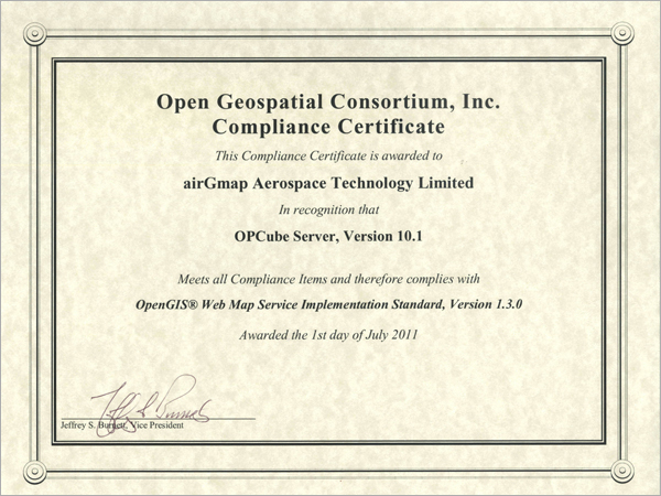
OGC Compliance Tests Passed

Applications