Features
- Interface for Various "Map Service" Sources, Such as: Google Map Service, Microsoft Bing Service, Nokia Here Service, Map Box, OSM eMap, OGC WMS Service.
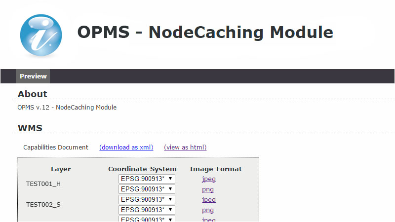
- Stands on OGC Standards and Wildly Support: TMS, WMTS, WMS.
- Accelerate WMS Service Efficiency: Support MBTiles / CouchDB.
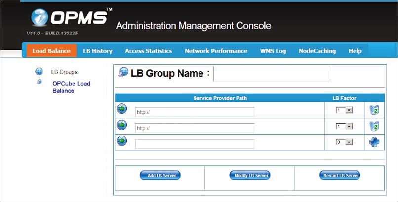
- Smart LB Services: Balance Asymmetry Service, Integrate Service Founds.
- Support Online and Offline Imagery Service.
- Provide Services Access Statistic and Performance Monitoring.
- Overcome Diverse 2D/3D Clients Data Source Inter-operate Issues: Skyline, Google Earth, ESRI Series and Portable Applications, etc..
Functional Specifications
- Support 64-bit Redhat Linux or CentOS Linux.
- Support the platform for digital upload of oriented images and original data download.
- Support oriented images published automatically onto WMS and WFS.
- Support the function of background process management and images publishing management.
- Process management must meet the standards of not only ISO/TC211 19115 and 19115-2 metadata, but also ISO/TC211-19139 operating regulations.
- Metadata constructing offers users to manage the editing by Web-based and Client-Server. The software users have can also support the combination of OIMS data publishing and downloading.
- Support the function of process management including data verification, audit management, account information, authority information and image catalog, etc..
- Users have authority to proceed digital saving and to own unlimited uploading capacity within the same LAN.
- Support the ability of high-speed computing cluster and heterogeneous data server-side loading balance.
- Support the virtual machine to backup the management structure, and is able to present high-speed computing performance and to deploy the clouding machine group for gaining carbon reduction benefits.
More Powerful Management Console