Do It Yourself
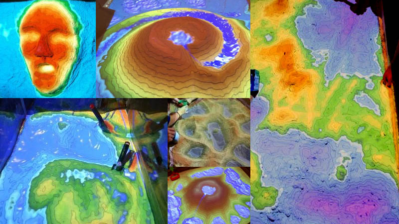
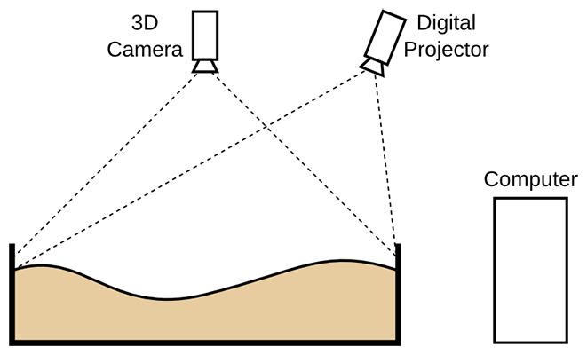
we are primarily developing 3D visualization applications to display earth science concepts, we also built a hands-on exhibit combining a flooding box, and virtual topography and water created using a closed loop of a Microsoft Kinect 3D camera, powerful simulation and visualization software, and a data projector. The resulting flooding box allows users to create topography models by shaping real sand, which is then augmented in real time by an elevation color map, topographic contour lines, and simulated water.
Features
- GPU Computation Technology
- Real time contour lines
- Natural Simulation Effects
- Rainfall / Snow
- Includes more than 3TB of global data.
- Flooding
- Volcanic Eruptions
- Groundwater settlement
High Quality Display